One of Suffolk County Council’s top priorities was to tackle highways flooding and, as part of their Smarter Suffolk Live Labs Project, funded by the Department for Transport (DfT) through the £22.9m ADEPT SMART Places Live Labs Programme, committed to providing a highway network that was more resilient and accessible during heavy rain and severe weather events.
As part of their flood management programme, the Council wanted to see if sensor technology could enhance their drainage maintenance armoury.
Already, users of KaarbonTech’s Gully SMART software to manage their drainage network, they were looking for additional technologies that could give them even better insight into the operational profile of each gully, and to use that insight to make accurate, pre-emptive changes to cleansing routines to reduce the risk of flooding.
Gully sensors were installed across the network to detect actual water levels.
KaarbonTech worked with Suffolk County Council (SCC) to trial and prove the suitability and value of using gully sensors alongside their traditional reporting systems, to provide real-time water level information to their highways and flood management teams.
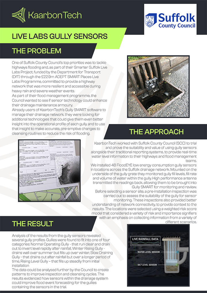
We installed 48 FloodEYE low energy consumption gully sensors in locations across the Suffolk drainage network. Mounted on the underside of the gully grate they monitored gully fill levels, fill rate and volume of water within the gully. A high-performance antenna transmitted the readings back, allowing them to be brought into Gully SMART for monitoring and review.
Before selecting a sensor site, a pre-installation inspection was carried out to assess the suitability of the gully for sensor monitoring. These inspections also provided a better understanding of network connectivity, to provide context to the results. The locations were selected using a weighted risk score model that considered a variety of risk and importance signifiers with an emphasis on collecting information from a variety of different scenarios.
Productivity was increased, with a greater understanding of the network and reliable programmes.
Analysis of the results from the gully sensors revealed several gully profiles. Gullies were found to fit into one of four categories:
Normal Operating Gully - that runs clear and drains out to invert level rapidly after rainfall
Winter Rising Gully - drains well over summer but fills up over winter
Slow Draining Gully - that drains out after rainfall but over a longer period of time
Rising Level Gully – that fills up steadily from initial installation
The data could be analysed further by the Council to create patterns to improve inspection and cleansing cycles. The results evidenced how sensors within the drainage system could improve flood event forecasting for the gullies containing the sensors in the trial.
"This project improved flood forecasting in Suffolk, thanks to gully sensor data analysis.
"