

Our service-specific software brings together asset, inspection and operational data to create a clear, risk-based understanding of your network. Map-based visualisation, data modelling and seamless integrations enable you to plan, prioritise and deliver services more effectively.
We create accurate asset inventories, validate condition and audit fieldwork across services through structured driven, aerial and walked surveys. This builds a reliable, consistent dataset to improve work programmes, strengthen decision-making and support risk-based management.
We bring together data, insight and experience to help you understand your network, improve service delivery and plan effectively. From operational support to strategic guidance, we help you deliver resilient, evidence-led services and build a clear case for investment and funding.
Traditional, disconnected and under-optimised approaches slow organisations down. We work with over 70 local authorities to bring together data, insight and delivery across infrastructure services, creating a clear, joined-up understanding of networks and risk.
By connecting software, surveying and professional services, we help you move from fragmented information to confident, evidence-led decisions that improve service delivery, strengthen resilience and support long-term planning.
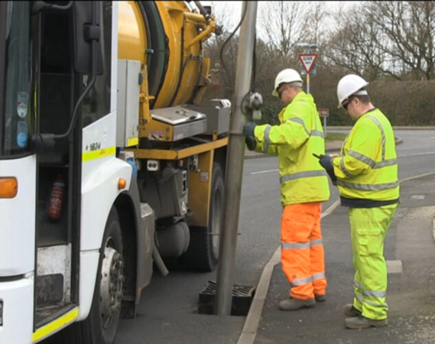
Understand and manage your drainage network as a complete system, not just individual assets. From gullies and pipelines to SuDS and surface water, we bring together survey data, operational activity and network insight to build a clear, evidence-led understanding of condition, performance and risk.
Through integrated surveying, software and professional services, we help you move beyond reactive maintenance to a structured, risk-based approach, improving network visibility, supporting preparedness before storm events and enabling more effective, resilient drainage services for your communities.
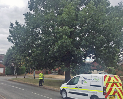
Understand your tree population through structured driven, aerial and walked surveys, consistent inspection methodologies and real-time data capture. From condition assessments to risk categorisation and maintenance planning, we provide a clear and reliable understanding of your tree assets.
Our software brings together live survey data, inspection history and ongoing activity, enabling you to manage risk, plan maintenance and prioritise work programmes effectively. Supported by professional services, we help you deliver a consistent, risk-based approach to tree management that improves safety and supports long-term environmental outcomes in the face of climate change.
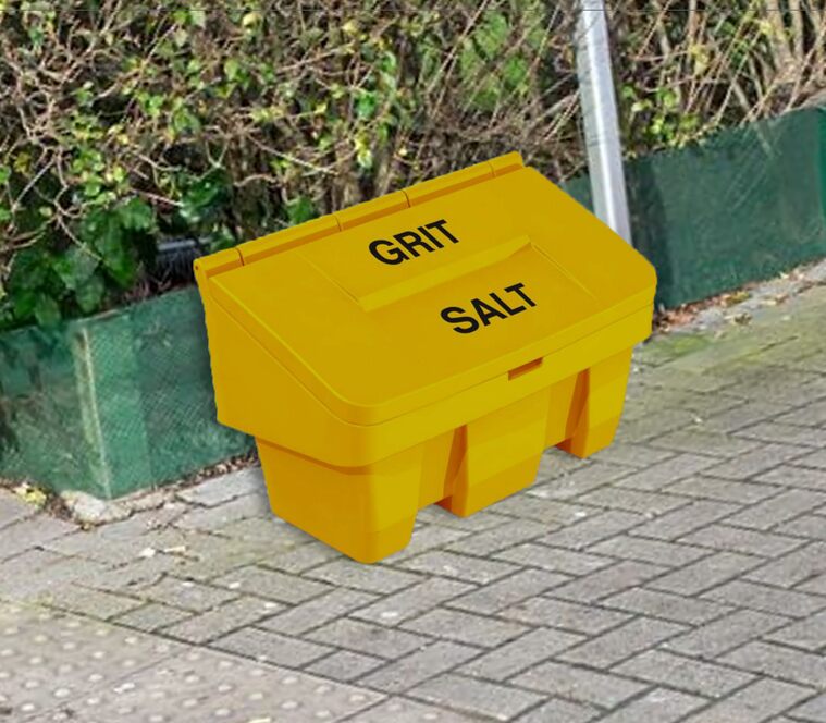
Understand and manage your winter maintenance service through a clear view of your network, grit bins and operational activity. From inspections and stock levels to refilling, maintenance and demand, we bring together the data needed to deliver effective and reliable winter services.
Our software provides real-time visibility of grit bin usage, service history and wider activity, enabling you to prioritise work, manage resources and respond to changing conditions, while supporting efficient, evidence-led winter maintenance across your network.
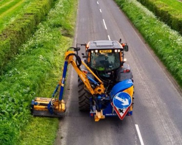
Map, measure and monitor greenspace activity to improve visibility, utilise equipment effectively and keep stakeholders informed. From seasonal maintenance and differing cut frequencies to wider greenspace assets, we bring together operational data to support consistent, efficient service delivery.
Our software provides a clear view of work programmes, performance and outcomes, enabling you to plan effectively, demonstrate value and manage greenspaces in a way that supports communities and enhances environmental outcomes.
"KaarbonTech has revolutionised the way we operate. Risk scoring has to be the future of the industry, it’s the only way for it to move forward.
"