

Building a clearer picture across the network
Every highway network contains locations that demand greater operational awareness. They may be known flood hotspots, busy junctions, low points in the carriageway, areas affected by leaf fall or locations where defects repeatedly develop. They are often places that teams return to time and again because conditions can change rapidly and have a wider impact on the surrounding network.
Authorities already monitor these locations through routine inspections, customer reports and reactive responses. The challenge is that many of the issues affecting them develop gradually, or emerge between planned visits, making it difficult to understand exactly when conditions changed or how they evolved over time.
Seeing how conditions develop
Surface water may begin to build long before it becomes a flooding incident. Gullies may gradually become obscured by leaf fall, reducing their effectiveness before anyone arrives on site. Cracking, potholes and carriageway deterioration often develop progressively, while road markings, signs and other highway assets can deteriorate over weeks or months rather than overnight.
In colder weather, certain locations may also become prone to standing water or ice formation, creating recurring seasonal risks that are difficult to fully understand through occasional inspections alone.
Without regular visibility, operational teams are often relying on isolated observations to manage locations where conditions are constantly changing.
Building evidence through regular image capture
SMART Shot AI has been developed to help authorities build that missing evidence.
Using self-contained monitoring units that can be rapidly deployed wherever additional visibility is needed, SMART Shot AI combines regular image capture with AI-powered review to create a visual history of how conditions develop over time. Solar-powered and operating through its own independent network connection, the units can be positioned at locations where installing permanent infrastructure would be difficult or where temporary monitoring would provide valuable operational insight.
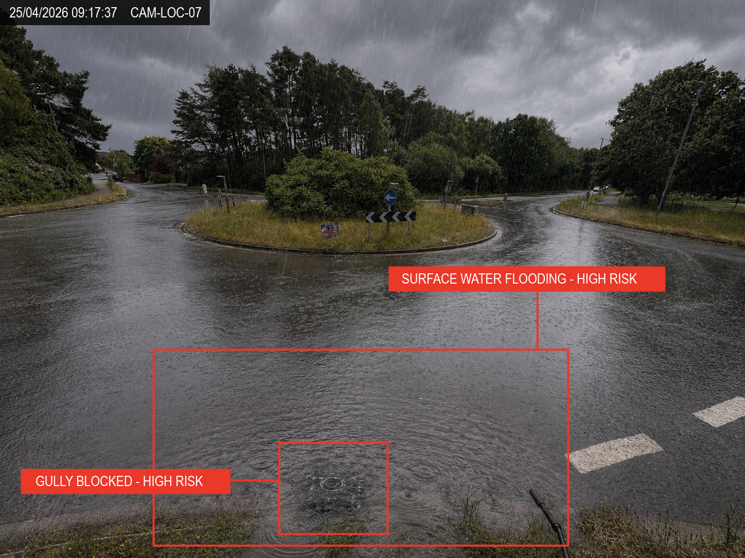 Rather than replacing inspections, SMART Shot AI complements existing maintenance programmes by providing additional evidence between site visits and highlighting visible changes that may require further investigation.
Understanding how the network behaves
The value extends well beyond identifying individual defects.
By reviewing images captured over weeks and months, authorities can begin to understand how different parts of the network behave under varying conditions. A junction may consistently collect standing water following prolonged rainfall before naturally draining several hours later. Leaf fall may repeatedly obscure drainage assets during particular periods of the year. A carriageway defect may deteriorate steadily over successive weeks, helping teams better understand how quickly intervention becomes necessary.
Over time, this creates a richer understanding of the operational characteristics of individual locations rather than simply recording isolated incidents.
Supporting more informed operational decisions
That additional understanding can support a wide range of operational activities.
Inspection programmes can become more evidence-led, maintenance can be better targeted and recurring issues can be understood in greater context. Images captured over time can also support investigations, provide evidence following incidents and help authorities demonstrate how conditions developed rather than relying on a single point-in-time observation.
Importantly, it allows operational teams to build confidence in how vulnerable parts of the network perform throughout changing weather conditions, seasonal events and day-to-day operation.
Looking beyond today’s inspection
Routine inspections will always remain a fundamental part of highway asset management. SMART Shot AI is designed to strengthen that process by providing another layer of operational evidence between visits, helping authorities understand not only what a location looked like, but how it changed, how it behaved and when intervention could have the greatest benefit.
As authorities continue to adopt more evidence-led approaches to network management, understanding how critical locations behave over time may become just as valuable as understanding their condition.